Route Intelligence
Do you know the routes, elevations and distances for every trip you run?
ETI360 turns an available route into a measured record: the map, distance, elevation, terrain, waypoints and relevant access information in one reviewable document.
The planning question
A routed activity needs to be understood as a route.
A school reviewing a cycling, hiking or expedition day needs more than the activity name. It needs to see where the route goes, how long it is, how the terrain changes and what operational information sits along it.
ETI360 brings those details into one consistent Route Intelligence Summary. The school can review the physical shape of the day, and the people operating it can use the same reference.
A real worked example
The Big Itoshima cycling route, shown as a complete operating day.
The route begins and ends at Chikuzen-Maebaru Station in Fukuoka. The page combines the mapped loop, 10 km waypoints, nearest verified facilities and the four figures that frame the ride.
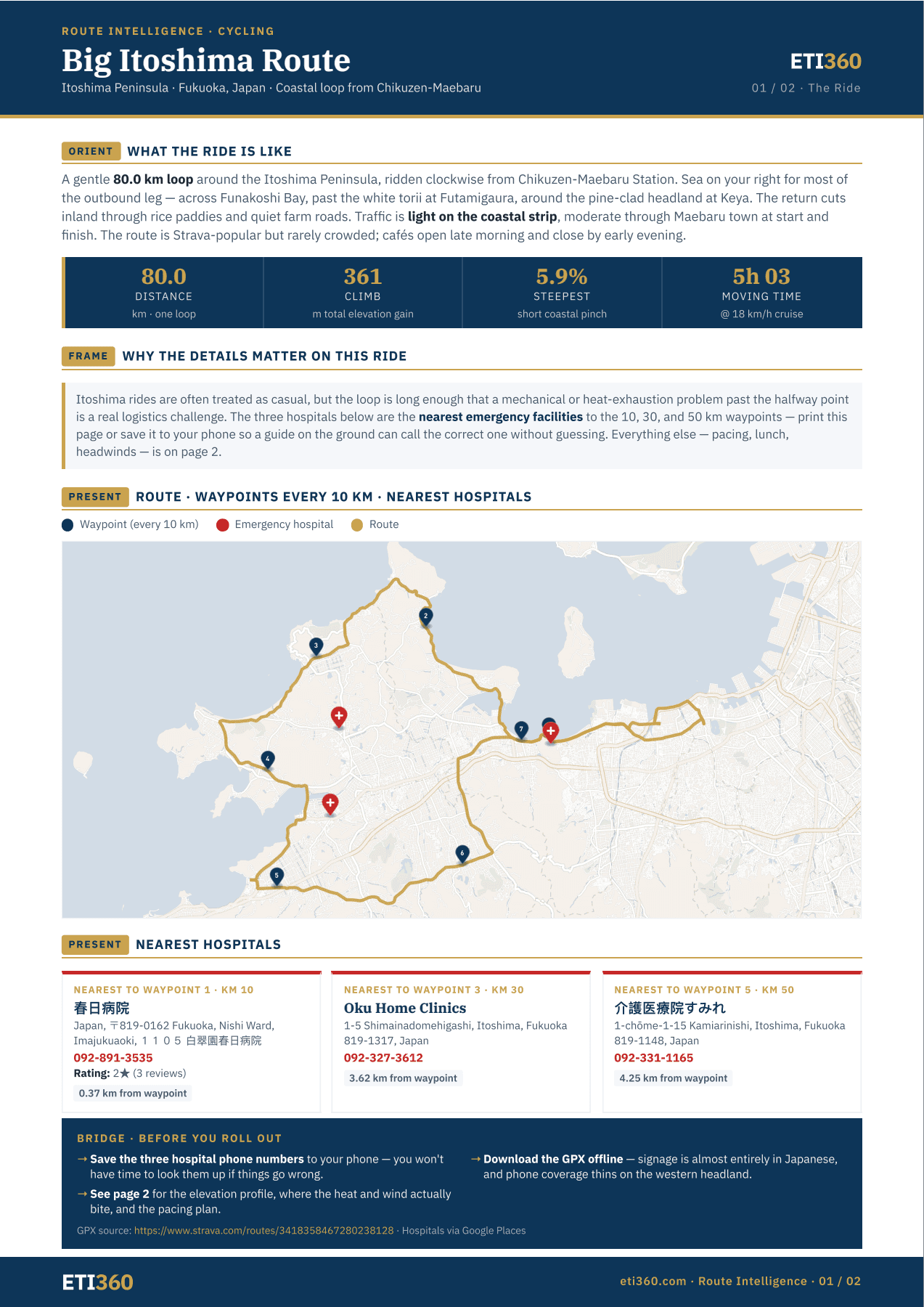
The map is not decoration. It is a working index to the route.
One visual connects the route geometry to shared waypoints and relevant facilities. The reader can see the whole day before moving into terrain, pacing and conditions.
The route
The complete 80 km loop is visible as a route, not simply named as a cycling activity.
The waypoints
Ten-kilometer markers create a shared reference for timing, progress and communication.
Medical access
Verified facilities are connected to relevant waypoints with addresses, telephone numbers and distance.
The shape of the day
Distance, climb, steepest section and estimated moving time are shown before the operational detail.
The second page
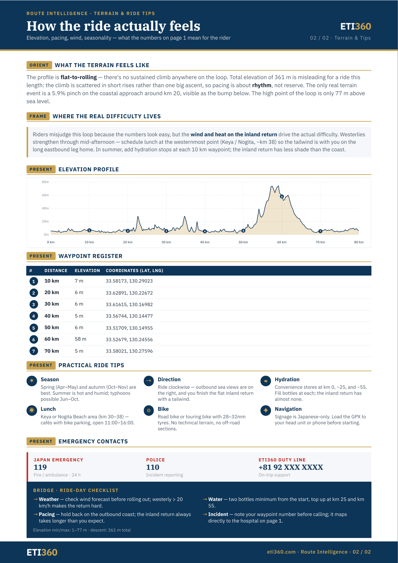
The map shows where. The profile explains how the route feels.
Page two turns the same route into the working detail for review and ride-day preparation: elevation by distance, waypoint coordinates, terrain cover, seasonal context, pacing and practical operating notes.
- Elevation
- The profile shows where the climbing occurs, not only the total.
- Conditions
- Sun, terrain cover and seasonal context shape the preparation.
- Waypoints
- Coordinates connect the map, route progress and communication.
- Operations
- Contacts and ride-day notes place the analysis into use.
Where this applies
For routed activities where the route itself matters.
Cycling days, hikes, expedition stages, river corridors and other activities with a defined route can carry Route Intelligence. The level of detail follows the activity and the source information available.
The route is one part of a complete trip file.
ETI360 also structures timings, locations, accommodation, facilities, parent information and the operating view used while groups travel.
A practical starting point
See one of your own trips this way.
Send an itinerary for a trip already in planning. We will show you what the structured trip file would contain and whether Route Intelligence applies.